|
Village of Nunda
Historical Walking Tour
|

|
Welcome to the Nunda Historical Society's Village of Nunda Historical Walking Tour, a joint project of the Society and the "Be Well in Livingston County" Initiative.
The material below is designed to supplement the information found on the walking tour brochure available after March 1st in a box at the Nunda Historical Society pavilion. |
|
Stop 1 Knife Factory (Nunda Historical Society) |
This building began as one of several knife manufactories that existed in Nunda. The largest was the Woodworth Knife Works that once stood on Woodworth Lane. The large grinding wheel in the pavilion came from the Woodworth factory. Nunda made knives, including knife blades made at this building, are on display in the Nunda Museum.
Right: Our Historical Building as it looked in the 1930s when it was the Brown & Kleinhenz Garage.
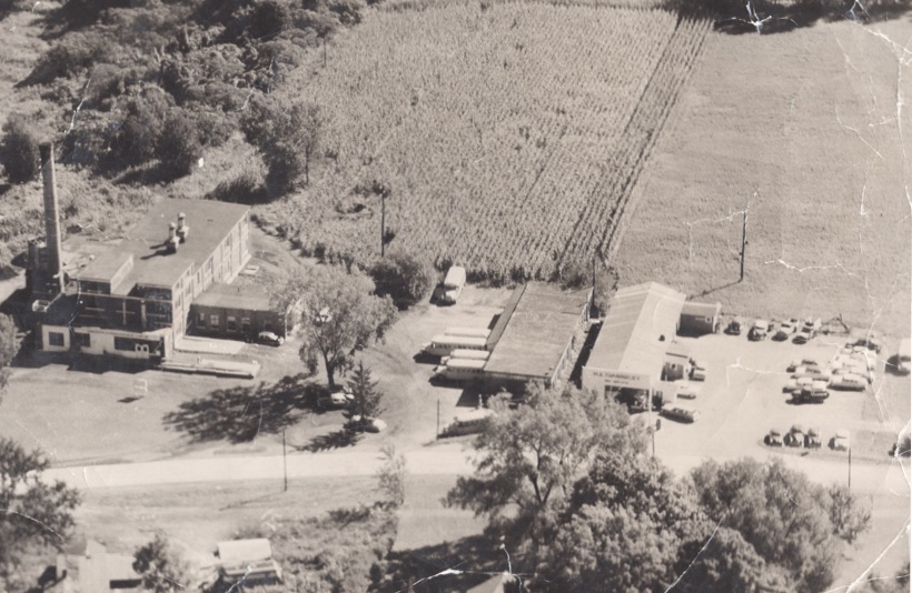
Below: This photograph was probably taken in the late 1940s. M.E. Tunningley's Garage ( the present day Historical Building) is visible to the right. On the left is the Conesus Milk Producers' Cooperative Association plant which produced condensed milk for several decades. The plant was demolished around 1980. The building in the middle served as the Nunda Central School's bus garage. It is now owned by the Nunda Kiwanis Club. The organization also owns and operates Kiwanis Field which now occupies the fields seen in the upper half of the photograph. |
 |
|
|
Stop 2 Village Building (Police Station)
|
|
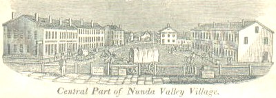
Above: If you were standing in the south end of the Village Square around 1840 looking north, this is what you would see. The buildings on the right (Merchant's Row) are still standing. Several of the buildings on the left (Farmer's Exchange) also remain. The old Eagle Hotel once stood at the north end where the Livingston House now stands.
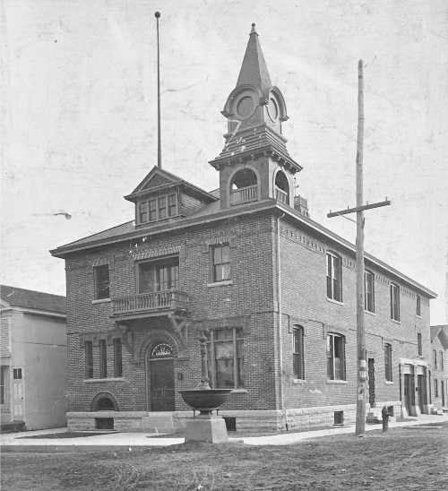
Right: This image of Nunda's first municipal building was appeared on a local calendar only a few years after the building opened in 1900. Note the bell tower and the fountain that once stood in front of the building.
|
|
|
|
Stop 3 Farmer's Exchange (Nunda Family Pharmacy)
|
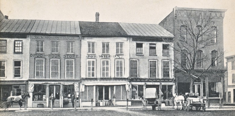 |
Left: This postcard shows the row of buildings known as the Farmer's Exchange around 1905. W.Y. Robinson had purchased the drug and book store from Dr. J.V.D. Coon in 1902. The building partly visible on the left was once a bakery and is now part of the Nunda Family Pharmacy.
Note the changes that have taken place in the front of the brick Lake Building to the right. The present day stone front was added to the building when the Nunda Bank opened on the first floor just after WWI. |
|
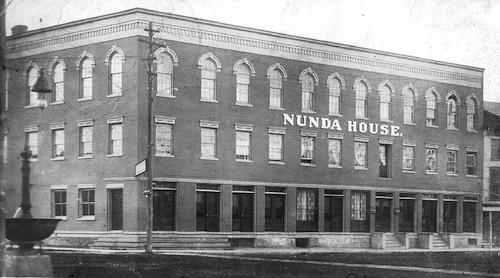
| Right: The Nunda House once stood at the south end of the Farmer's Exchange. Built in 1836, the building served as one of several local hotels. Originally two stories, the third story was added by John Barber after the Civil War. Barber's bank, which occupied the north portion (right) of the first floor, later became the Peter DePuy Bank. In later years the building became known as the "Fox Hotel" and was operated by Maggie Fox, who ran a bar on the first floor south of the bank. The Nunda House was torn down in 1962 to make way for the modern bank building. This photo comes from a real photo postcard around 1910. |
 |
|
Stop 4 Merchant's Row (Enchanted Ink)
|
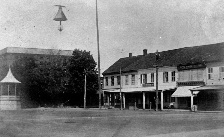
The two images below show the east side of the Square known as Merchant's Row. The first was taken around 1900. At that time the "City Drug Store" (now Enchanted Ink) changed owners from druggist Harrison Peck, son of US Congressman Luther Peck, to the colorful Frank "Rexie" Wright" a Spanish American War veteran. Note the band stand that once stood in the Square and the early street light.
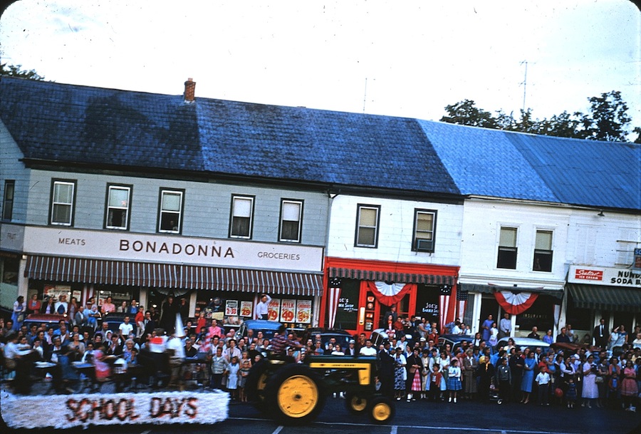
The second image shows Merchant's Row in the summer of 1958 during Nunda's Sesquicentennial Celebration. By that time the block included Bonadonna's Grocery, Joe Piraino's Barber Shop, Ryan's Insurance, and the old City Drug Store which had become the Nunda Soda Bar. You will find a 1866 photo of the Square here. |
|
|
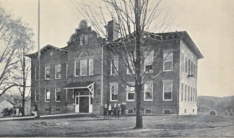
Stop 5 Keshequa Central School
|
The school to the right was the Nunda High School as it looked around 1920. By this time original Nunda Academy (the section on the right) had been expanded to accommodate more public school students. At one time two district schools (one room schools) stood on the front lawn. The present day school was built around this building in 1938-39 and the old school was razed. |
 |
|
| As you are walking to Stop 6 you may want to note the second house on the right hand (south) side of Center Street. This was one of the two district school houses that sat on the Academy grounds. It was sold and moved to its present location after 1904 and at one time served as an Adventist Church. It has been renovated into a home. |
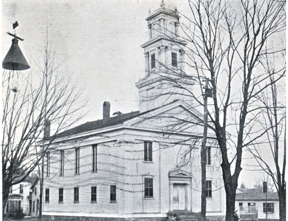
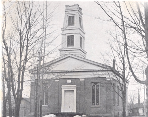
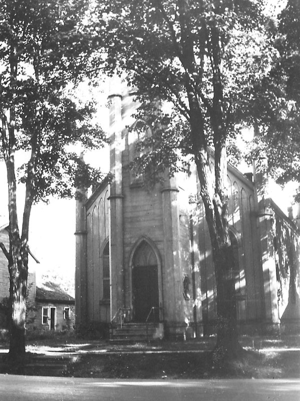
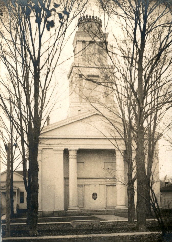
Stop 6 Nunda United Methodist Church
|
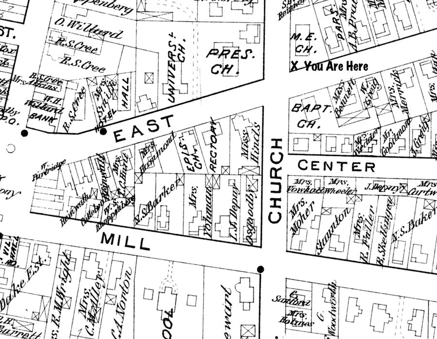
The 1902 map below will help you with Stops 6 & 7. Your location for Stop 6 is marked on the map. |
|
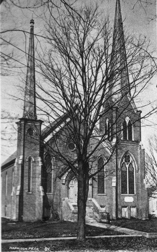
The images below show the churches of East Street as they looked around the time the 1902 map above was made. From left to right they are: First Row: Nunda United Methodist Church, First Baptist Church (before the 1917 fire); Second Row: Grace Episcopal Church, First Presbyterian Church, and the First Universalist Church of the Redeemer. Use the above map to find the location of these churches. The book "Church in the Town of Nunda and Vicinity by Hope DePuy and Sally Hall tells the story of each of these churches. It is availalble at the Nunda Family Pharmacy or through this website along with several other local history books published by the Society. |
|
|
Stop 7 Bell Memorial Library
|
|
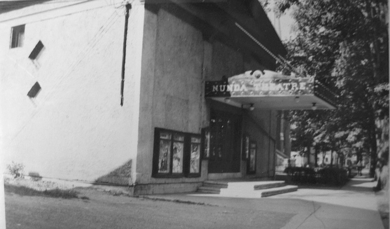
| The image above shows the library not long after it was completed. The house that originally stood on the spot was moved to 16 South Church Street to make way for the new building. On the left a portion of the original Universalist Church can be seen. This building became the Academy of Music and later, the Nunda Theatre. The photograph below shows the movie house in its heyday. |
| |
Stop 8 Livingston House (Pizza Corner)
|
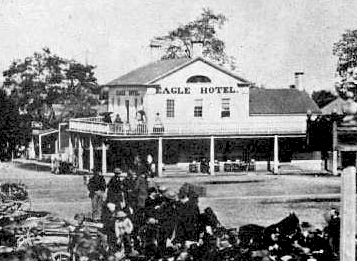
Below: The old Eagle Tavern (later "Hotel") once stood on the site of the Livingston House. Built in the early 1830s, the old Eagle served as an early gathering place in the Village. The building was moved down East Street and once stood on the site of the repair shop next to the Bell Memorial Library parking lot. You can see this full 1866 photograph here.
Right: The Livingston House as it looked in the 1890s. Note the balcony the once existed on the State Street and East Street sides of the building. If you look closely, you can still see traces of it on the present day building. |
|
|
 |
|
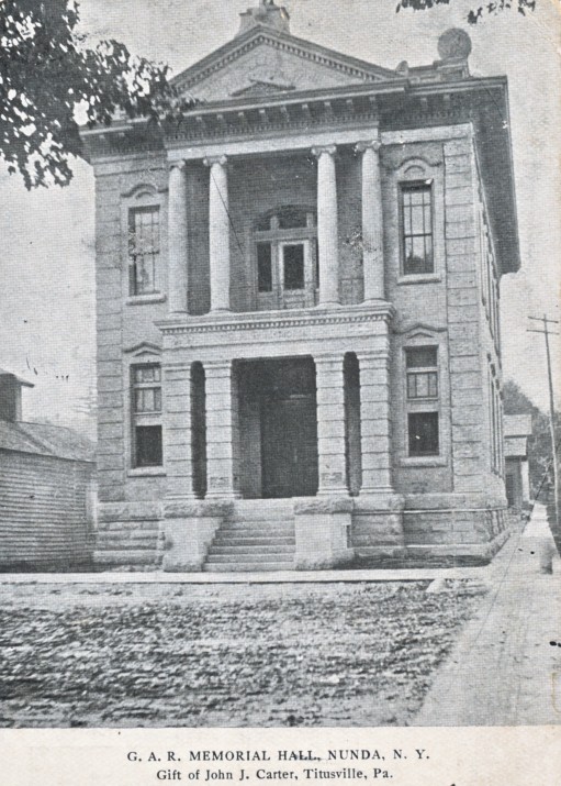
Stop 9 Carter Memorial Building |
|
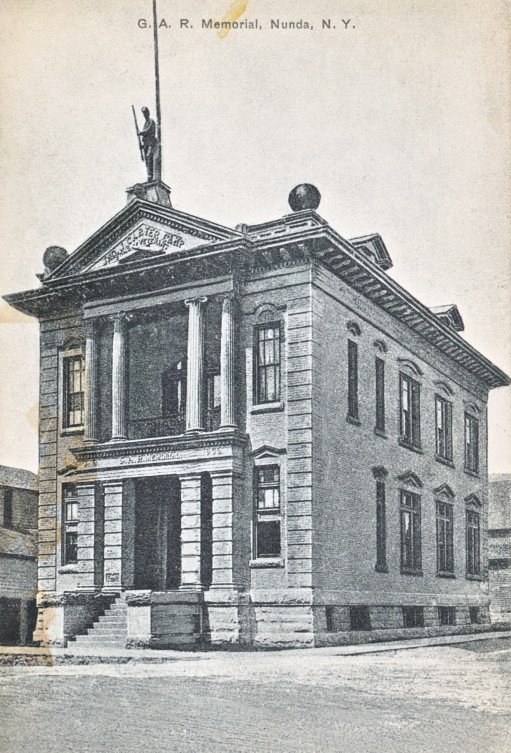 |
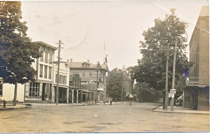
Above: This view was taken around 1910 from the Square looking north up State Street. The Livingston House is on the right. The building marked "Post Office" is now Kathy's Country Florist. Down the street you can see the Carter Memorial Building with its Civil War Statue on the top. The Union Block (Stop 10) is beyond.
Left and Right: These postcards show the building around 1908 . After WWI cannons were added beside the front staircase. We believe they were turned into scrap during World War II.
Although the proper name for this building is the Carter Memorial Building Or Hall, it is often referred to as the G.A.R. (Grand Army of the Republic) building or the American Legion Building. |
|
|
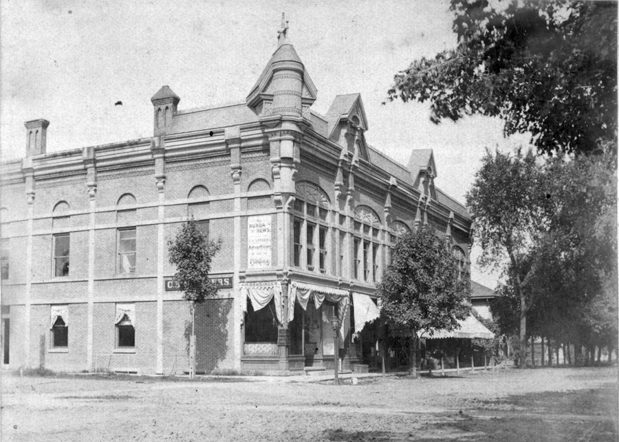
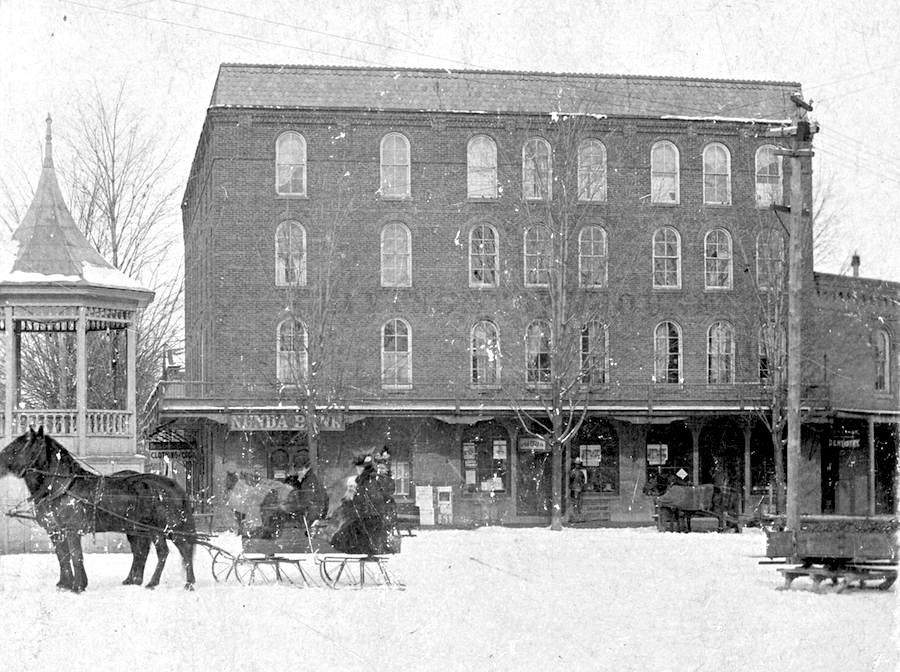
Stop 10 Union Block |
The photograph below shows the Union Block in the late 1880s or early 1890s. The Nunda News (1859-1982) occupied part of the second floor. For many years the Post Office was in the southeast corner of the building.
The busy Union Block of the 1940s is seen in the second photograph below. Not that the roof facade has been removed. Older folks may fondly remember Stanton's IGA and Duncan's Dry Good Store. |
|
|
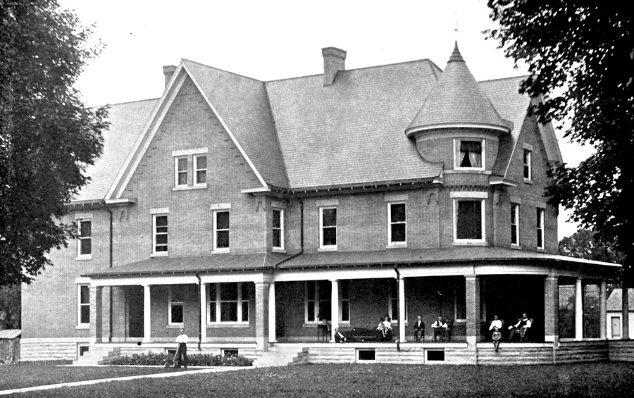
Stop 11 DePuy Mansion (Nunda Government Center)
|
| Isaac J Depuy and his family relax on the porch of their new home in the early photograph below. Go to "A Description of the New DePuy Home on Massachusetts Street" for more information on this building that now serves as Nunda's Town and Village Government Center. Many area residents were born here when the building operated as the Nunda Hospital. |
|
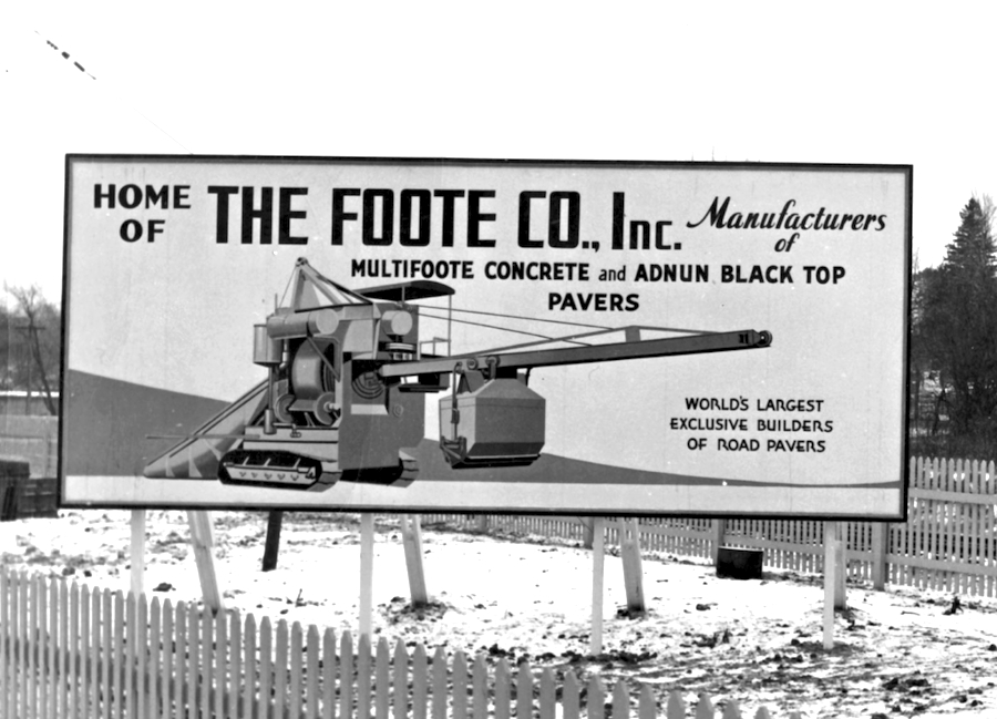
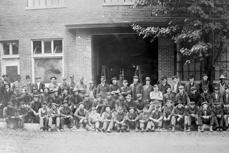
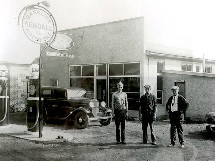
Stop 12 Foote Factory (Seating Inc.) |
Right: Employees of the Foote Company pose in front of their factory in September 1914. For many decades the company was Nunda's leading employer.
Below: This sign once created visitors entering the village on the State Road (Route 408). It depicts one of the Foote Brother's famous road paving machines that were shipped throughout the United States and Europe. During World War II these Nunda made machines were used in the construction of Allied airstrips.
Use these links for more images of the factory and workers. |
|
|
|
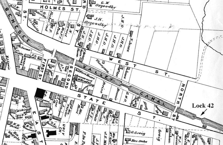
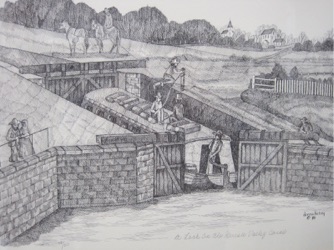
Stop 13 Genesee Valley Canal Lock
|
Below: The map is taken from the 1872 Atlas of Livingston County. Lock 42 has been labeled in the lower right. You can refer to this map at Stops 13, 15, and 16. Note that there were several locks and canal bridges within the village.
Right: This drawing by Donna Kelsey gives an idea of what Lock 42 might have looked like when it was in operation.
|
 |
|
|
Stop 14 Oakwood Cemetery |
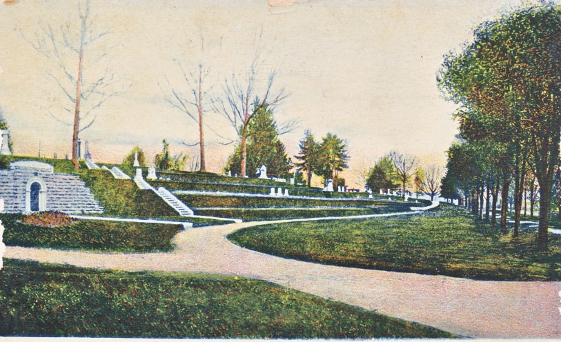 |
This hand colored postcard shows the West Street Entrance to Oakwood Cemetery not long after the vault was built. West Street is to the far right. Note the size of the oak trees at the top of the hill. Just visible in the center of this image is the Nunda Soldiers' Monument, erected in 1897. The Monument was restored for the Cemetery's 150th anniversary in 2015.
Be sure to take the opportunity to explore these beautiful and historical grounds! |
|
|
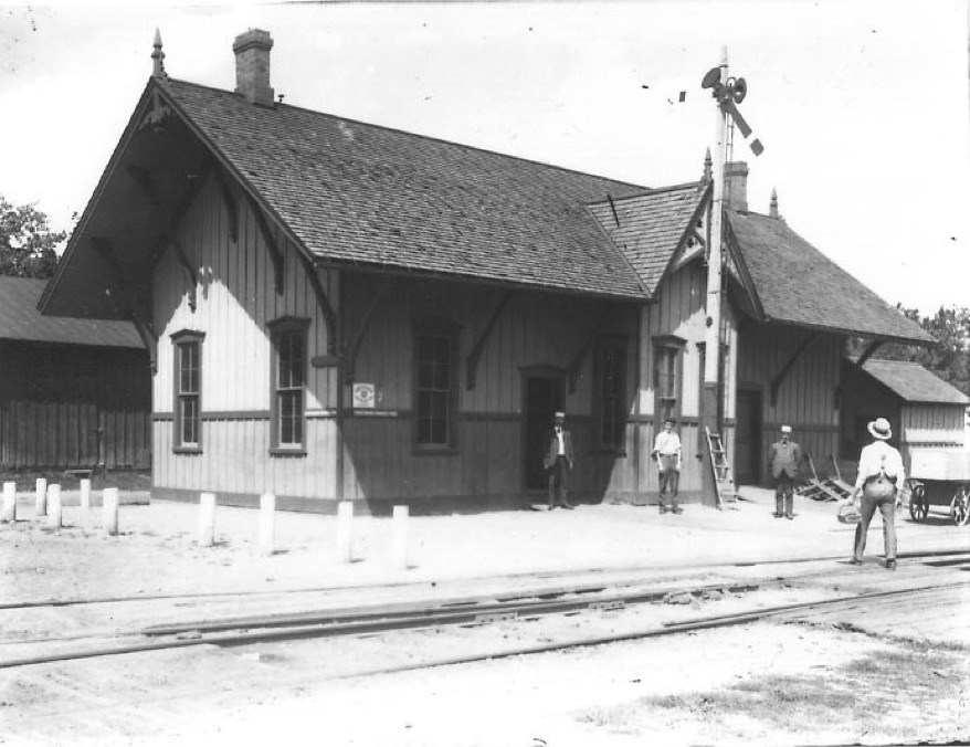
| Please refer to the map above for the placement of this building and the canal. It is marked "C Rose Warehouse" and was on the west side (up on map) of the canal. Note that there was once a bridge on Second Street just south of the warehouse. You can see the warehouse in the photograph below probably taken around 1915. It is located behind and to the left of the Pennsylvania Railroad Station, which was built on top of the old canal bed. |
|
|
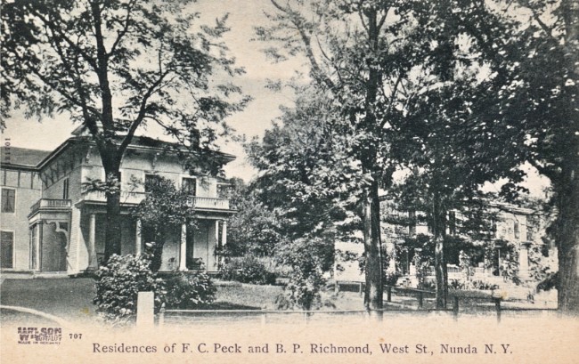
You will also find the B.P Richmond family on the 1872 map above - note how close it was to one of the locks on the Genesee Valley Canal. Although this section of the canal was not opened until 1851, work on the canal had started in 1836! In a letter dated August 23, 1839 Bradford Richmond complained "The canal progresses slowly in front of our house. They will not get to work on the lock before next summer and we shall have to climb over a bank of dirt...." Later the Richmonds would have been able to watch the canal traffic their front porch.
Bradford and his wife Anna are buried in the Richmond/Whitcomb Vault in Section OC2 of Oakwood Cemetery. The postcard shows the Richmond house (on the left) around 1910. |
 |
|
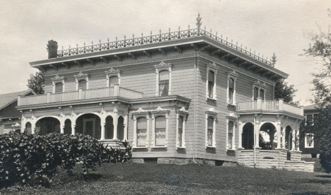 |
This real photo postcard shows the Gibbs house about 1920, when it was the home of the Fred Dake Family. Although the fancy iron work on the roof is gone, much of the ornamentation is still visible.
During canal days there was a bridge over the canal at the foot of Gibbs Street. Not far west of the intersection is a historical sign (recently restored by the Historical Society) marking the first of 17 locks that carried the Genesee Valley Canal out of the Keshequa Valley. |
|
| We hope you enjoyed this historical walking tour. You can find out more about the history of the Nunda area through our website and visiting the Nunda Museum and Rose Shave Gallery. Watch for addition self-guided history tours of the town and village! Be sure to check out our list of upcoming activities and events! |
| |